THE LONG ROAD HOME
Prelude
It only took me SEVEN MONTHS to start creating this post. Three months after I began that effort, I have finally finished. There are a host of reasons, and they tend to run sequentially. The move arrangements, packing, and loading ate up late April and May. The drive south commenced on June 1. With visiting family and friends in Colorado, returning to Montana, purchasing various furniture pieces in advance of the truck arrival, the eventual unloading in early July, and hiking season in Yellowstone, I was a busy boy all through the summer and fall. Complicating matters, I rejoined Facebook in the spring, after a 5 or 6 year absence. I joined the Yellowstone Up Close and Personal group and the Yellowstone Hiking group, and was posting trip reports, with photos. In the fall, I started adding video clips to some of the trip reports, and hope to do more of that over time. Just about the time the interior roads closed in Yellowstone, I started working, and those 40 hour work weeks are time consumers. I’m betwixt and between on whether I will try to post hike trip reports on this blog, like I did years ago. The readership is so much larger on Facebook. For anyone who is interested in seeing those reports, if you are on Facebook, just look for “Ballpark Frank” in Bozeman, Montana. I have them mounted as “public”, but I have heard from a few people that they were unable to access them. There are a series of photo albums, almost one a week through the summer and portions of the fall, with a few winter reports covering ski outings primarily. The report narrative is in the description portion of the images. If you want easy access to the albums, just send a Friend request. That will give you unfettered access.
Preparation
The single biggest expense in most moves is the carting of household goods and other personal property from Location A to Location B. A move to or from Alaska is much more like an overseas move than a typical interstate move in the Lower 48. We lucked out big time in that the movers that handled our 2012 relocation to Alaska from Montana gave us a sizeable discount that seemed to be close to 50% off. It amounted to a “repeat customer discount”. The one complicating factor in this particular move was dividing an existing household in two, and requesting what amounts to a “split load”. Jane wanted her belongings unloaded at her house, and I wanted mine delivered to my house. To their credit, the moving company managed that aspect of the project with minimal conflict and/or confusion. Jane and I developed a system of identification designed to insure our belongings arrived at the correct destination, and we supervised the loading to as great an extent as possible. Even with our best efforts, a few items were mis-delivered. Actually, they would have been, but by keeping a sharp eye on what was coming off the truck in July, we managed to redirect at least 5 items via the moving van.
In a piece of amazing irony, our next door neighbors, who we had lived next to for four years, were moving at almost the same time. Jason was an anesthesiologist in the Air Force, and was being transferred to San Antonio. He and Cammy had 4 children, Sierra, Marcus, David, and Clint (in descending order of age, I think). They loaded their truck several days before we did. Thankfully, I got to spend some time with them on several occasions, when they were back at their house, cleaning or organizing the belongings that were going with them in their large tow vehicle that was going to be pulling their long trailer all the way to Texas. They told me they were going the same route Jane and I took on our way up to Alaska in 2012. When they got to Montana, they planned to visit Yellowstone. They were hitting the road on Wednesday, May 31, while I was leaving a day after them, on Thursday, June 1. We joked about how we might see each other on the road, but I don’t think any of us really expected what eventually happened.
We loaded the truck on Tuesday, May 30. Several of the crew were Samoan fellows, incredibly beefy and strong. Jane and I stayed at a motel in Eagle River that night, as well as the next. On Wednesday, Jane spent the morning at her office. I let the cleaning crew into the house, then headed into Anchorage for a few last items of preparation, including changing some American dollars into Canadian dollars. NOTE for anyone planning on traveling to or from Alaska via the Alaska Highway: On the way up in 2012, I didn’t need most of the cash I had acquired. On the way back in 2017, I hardly used any of it. It’s still worth having some with you, but know that almost everyone takes plastic these days.
On Thursday, June 1, Jane headed to her office. Her plan was to drop off her truck with the outfit that was going to ship it to Montana. Her flight left Anchorage the next day. My plan was to hit the road from the motel, stop off at my favorite lunch spot in Peters Creek, visit my chiropractor one last time, and continue on to Tok for my first night’s stay, within an hour or two of the Canadian border. As I was carrying my luggage to my car, the manager on duty told me the housekeeping people had discovered some medication in the refrigerator in Jane’s room. He wasn’t sure what to do with it. Knowing that Jane was not going to have the means of retrieving the medication, and concerned that it needed refrigeration, I decided to drive it to Jane’s office at the university, since I was unable to reach her on the phone. That threw my departure behind by about an hour, which thwarted my lunch/chiropractor plans.
DAY 1, Thursday, June 1, 2017
It was a fairly nice day, weather-wise, one of those days you see quite often in late May and June in the Anchorage/Eagle River area. As I headed up the Glenn Highway, my mind was racing, considering a flood of extraneous thoughts that were bombarding my consciousness. I pondered the irony of how 5 years earlier we had arrived together, but now we were heading back to Montana separately. I thought about the fact that while I had hoped to get in a day or two of hiking prior to departing Alaska, the combination of cold, wet weather and the pressing needs of packing prevented me from getting anything beyond one quick foray down the hill to the campground along the river, below our subdivision. Shortly after my departure, a group of teens were destined to have a nasty encounter with a bear in that same area. The day I went down there, the campground hosts had just arrived and there were snowdrifts across the road in places. The only critters I saw were moose, which are abundant in that area year-round. I wondered what my new future would hold for me. At one point, the harsh reality of knowing I was totally on my own if anything went wrong on the long drive ahead occurred to me, and I recognized that I had to trust to luck that everything would go OK.
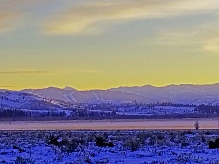
Folks that have driven the road that connects the Anchorage/Palmer/Wasilla area to Glenallen and eventually, Tok, will have undoubtedly seen the Matanuska Glacier from the highway. There are a series of pullouts that probably span a 20-25 mile stretch of that road, maybe longer, which afford views of this impressive glacier that does not reach the sea, not even Cook Inlet, or the Knik Arm of Cook Inlet. The glacier terminates a long ways from Palmer, and creates the Matanuska River, which flows into the Knik Arm after a 75 mile overland journey. Much like Denali and several vistas from mountaintops in the Chugach Mountains, the Matanuska Glacier always prompted me to take lots of photos whenever I was in the area. On this day, I was graced with by far the best weather ever for photographing the glacier. Since this was likely my last opportunity to see and capture images of this landmark, I am motivated to display a number of them in this report.
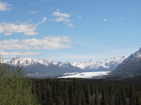
Figure 1 First glimpse of Matanuska Glacier

Figure 2 Zoomed in a bit from first pulloff

Figure 3 Zoomed in even further from first pulloff
The next series of Matanuska Glacier shots were taken many miles further east, looking south, while the first series of photos were taken from a perspective looking southeast. While the visible white portion of the glacier makes it appear like a thin ribbon of snow and ice, actually, most of the valley floor is covered by the glacier. The bulk of it, as you get into the lower reaches, is covered with dirt and rock, probably resulting from periodic melting of the upper portion, which is exposed to the long summer sun.
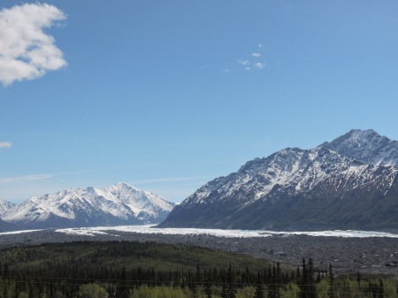
Figure 4 View to south, zoomed out

Figure 5 View to the southwest, with close-up showing “dirty” ice/snow

Figure 6 View south zoomed in a bit

Figure 7 View south, zoomed in further
I made one last Lower Matanuska Glacier view stop. It is the easternmost and last (when you are traveling west to east) look at the lower portion of this magnificent work of nature.

Figure 8 Looking southwest from easternmost viewpoint, zoomed out
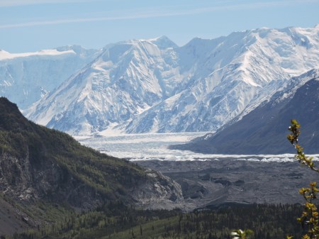
Figure 9 View southwest from easternmost viewpoint, zoomed in
If this seems confusing, don’t fret. It was confusing to me. I thought I had seen the last of the Matanuska Glacier, but after driving another 5 or 10, maybe more miles, I discovered a place where I could see the upper portion of the glacier. I suspect this area may have been obscured by clouds or fog on my previous trips through this area. It was one of several pleasant surprises that were in store for me on this precious afternoon.

Figure 10 View of upper portion of Matanuska Glacier, zoomed out
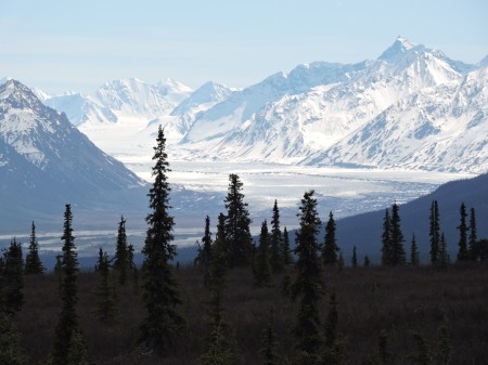
Figure 11 View of upper portion of Matanuska Glacier, zoomed in
At the place where I took the photos of the upper portion of the Matanuska Glacier, I was stunned to see what at first appeared to be shiny white clouds hugging the ground in the distance, way east. My guess was it had to be at least 50 miles, maybe further. I realized it was likely some distant mountains, and thought it had to be part of the Wrangell Mountains, which run along the border of Wrangell-St. Elias National Park, by far the largest national park in the system. I had only been in that area once since moving to Alaska. We drove through there on our way to Eagle River from Montana in 2012, but it was a rainy day, with clouds that hugged the ground. We knew the mountains were out there somewhere, but never got a look at them.
I know I had been in this area at least twice since moving to Alaska, but for whatever reason, probably clouds on the horizon, I had not seen these mountains from this area.
What is particularly amazing about the view from this spot is that my camera picked up much more detail than what I was seeing with my eyes. I have very good vision, so my suspicion is that the camera was able to “see” through the haze that was obscuring the mountains when I looked at them. Near as I can tell, those mountains were between 100 and 150 miles away. I learned when I reached Glenallen that some mountains were much closer than others. More on that later………….

Figure 12 Wrangell Mountains in distance, zoomed out – Mt. Sanford at far left, with Mt. Drum to the right, Mt. Wrangell further right, and Mt. Blackburn farthes right

Figure 13 Mt. Drum on right, Mt. Sanford at left

Figure 14 Zoomed in on Mt. Drum, with part of Mt. Sanford at left
This is as good a place as any to detail the relative positions and elevation of the four subject mountains. Ranging from left to right, we have Mt. Sanford (elev. 16,327 ft.), Mt. Drum (elev. 12,010 ft.), Mt. Wrangell (elev. 14,163 ft.), and Mt. Blackburn (elev. 16,390 ft.). Mt. Drum is by far the furthest west, so it appears quite large, while actually the lowest of the four. Mt. Wrangell is an active volcano. I spoke with a chamber of commerce employee in Glenallen who told me about volcanic episodes over the years that she has witnessed personally.
The clouds started gathering as I proceeded toward Glenallen. Once I got within 25 or 30 miles of the town, I started getting remarkable views of the Wrangell Mountains, particularly Mt. Drum. I could see Mt. Sanford, left of Mt. Drum, but not the uppermost part of the mountain.

Figure 15 The road points right at Mt. Drum. Mt. Sanford is at left. Mt. Wrangell is at right.

Figure 16 Mt. Drum and Mt. Sanford, zoomed in

Figure 17 Zoomed in on Mt. Drum
For those who live in close proximity to the 14ers common to Colorado or those arrayed north/south through the Cascade Mountains and High Sierras, and might be wondering why Mt. Drum, at 12,010 ft. elevation looks so big, keep in mind that the base elevation is only around 1,500 feet above sea level, so you are looking at about 10,500 feet of mountain.

Figure 18 Road construction just outside Glenallen, heading for Tok
The last series of photos are ones I took later that afternoon, as I was heading up the Tok Cutoff from Glenallen. There were dramatic views available of the Wrangell Mountains to the south as I was heading north. I think this is the Copper River in the foreground. I know I could see Mt. Sanford on the left, with Mt. Drum in the middle, and Mt. Wrangell’s dome-like structure on the right. I know the clouds were low enough that I could not see the very top of Mt. Sanford most of the time, but there were a few “magic moments” where the clouds lifted a bit. When that happened, I would start looking for a place to pull over and get photos. This was a bit difficult, since the mountains were behind me, over my right shoulder, but it was worth the effort.

Figure 19 Looking south down the Copper River toward Mt. Sanford on the left and Mt. Drum on the right.

Figure 20 Zooming in on Mt. Sanford

Figure 21 Zoomed in even more on Mt. Sanford

Figure 22 Looking south at the north side of Mt. Drum

Figure 23 Mt. Drum with Mt. Wrangell at right

Figure 24 Zoomed in on Mt. Drum from way up north
The road started developing serious quality issues about the time the views of the Wrangell Mountains dissipated. That’s a good thing, because I had to start concentrating on driving. There were serious frost heaves, some reminiscent of the nasty ones we had encountered on the Canadian side of the border near Destruction Bay back in 2012, when we drove up from Montana. In fact, this 15 or 20 mile section of road was by far the worst section of the entire drive, discounting the dirt/gravel section of construction by Muncho Lake in Canada. Having that 2012 experience was beneficial, and I managed to maneuver my way around and through the pot hole and frost heave “slalom” without suffering any obvious damage or bottoming out.
The weather, which was cloudy and cool most of the way up from Glenallen, started becoming progressively sunnier and warmer the closer I got to Tok, and by the time I reached the outskirts, I had my window down, with a blue sky above me.
The entire time I was driving toward Tok, I was experiencing growing cold symptoms. My throat was drying out in spite of my hydration efforts. My sinuses seemed to be plugged up, and I had significant drainage going down the back of my throat. These were ominous signs of potential nastiness to come. As soon as I checked into Young’s Motel, I called Jane, just to let her know I had made it to Tok. I mentioned the cold symptoms, and she suggested I buy some Nyquil to help me get through the night. It’s funny how you can get so focused on a single task, and go brain dead about anything peripheral to it. That is what happened to me. It had not dawned on me to get some sort of medication to at least alleviate some of the symptoms I was experiencing. As soon as I got off the phone, I went searching for a place to purchase Nyquil or something equivalent. After a bit of wandering, I located what I suspect is the only “store” in Tok, at least an establishment where you can procure groceries and other basic supplies. Thankfully, they were still open, because it was getting late. I was able to find Nyquil, as well as Dayquil for the next day. I paid an exorbitant amount for the two bottles. I can’t remember the exact total, but I remember thinking it was just under $20. I also remember thinking “Regardless of what it costs, it is worth it if it (1) helps me get a decent night’s sleep, and (2) enables me to stay on schedule with my long drive, since I had locked in my lodging at each stop along the way.
I went back to the motel, which is a fair-sized operation, and Fast Eddy’s, one of the few restaurants in Tok. I ate a fairly nice dinner, checked email, and went to bed.
DAY 2, Friday, June 2, 2017
Thanks to the medication recommended by Jane, I got a good night’s sleep. To facilitate my quick start to the day’s drive, I had a quick breakfast of beef jerky, a protein bar, and something else that I can’t recall almost 10 months later as I write this. While this was going to be another relatively light driving day, compared to Days 3 and 4 (only covering the same distance between Tok and Whitehorse that we traveled in 2012 on the drive north), I wanted to get moving, because I was getting a later than anticipated start, thanks to the Nyquil’s sedation effect, and I was hoping to have some extra time at the end of the day to do some exploring around Whitehorse, and scout out a good restaurant for dinner.
I was about to write “the traffic was light” as I left Tok, and then I remembered where I was. I doubt Tok ever sees anything resembling moderate or heavy traffic. There were a few vehicles, including a truck or two, in those first 4 or 5 miles, because you have scattered homes and businesses (like contractors and loggers) along the 2 lane highway that takes you to the Canadian border. Once I got 5 or 10 minutes outside Tok, the traffic was just short of non-existent. There was nobody ahead or behind me, and I would have a vehicle heading toward me maybe once every 3 or 4 minutes on average. Probably half or more of those were RVs, with people from the Lower 48 heading up to Alaska on vacation. Many of the remainder were 18-wheelers transporting everything from the belongings of people moving to Alaska to a variety of typical motor freight.
The weather was fairly nice, sunny with some clouds here and there. It gradually became mostly cloudy the further I went south. The drive from Tok to the border is only around 93 miles. There is not much in the way of spectacular scenery on that drive, so I was motoring.
WARNING: This paragraph contains a description of bodily functions gone awry, and the complications that followed. If you are not fond of reading about such things, I would recommend you skip to the next paragraph, which picks up right after I cleared Canadian Customs. Remember, you were warned! On the flip side, if you are anything like my old hiking buddy, Craig, and enjoy dry humor, and irony, you will love this. Unfortunately, my cold was acting up, and at one point, about a half hour south of Tok, I tried to blow my nose. Here I am, flying down the road, and trying to blow my nose at the same time. Bad move!! The next thing I knew, I had a veritable geyser of blood coming out of one nostril. I must have uncorked a gusher. There are no pulloffs along this part of the highway, so I was trying to manage driving and not getting blood all over my car and me. That puny tissue was no match for what I had unleashed, so I had to call in reinforcements. This is ironically funny and damn dangerous simultaneously. It wasn’t long before I had a mouth full of a mixture of phlegm and blood, and I wanted to get rid of it. Here’s Frank zooming down this narrow 2 lane highway, still in Alaska, so the foliage on the side of the road is not cut back all that much, the way it is in Canada. It’s early enough in the day, and early enough in June, that the ambient air temperature was probably in the 30s. I was going to spit the wad of unwanted material out of my mouth, feeling pretty comfortable that there were no vehicles coming the other way, and nobody behind me. I put the window down, turned my head, and let loose. I was probably traveling at 70-80 mph, and given what happened, I have to wonder if I was driving into a headwind. All I know is that the gruesome mixture did not go where I had intended it to go, well out onto the pavement. Instead, it was blown back against the side of my car. I looked in horror at the sprayed mixture of blood and phlegm that was plastered all over the side window behind me, and figured it was probably covering part of the door and rear fender. How nice! To make matters worse, the ambient air temperature, combined with my vehicle’s velocity produced enough of a wind chill that everything was almost immediately frozen into place. All I could think of was “how am I going to explain this to a Customs official?” I had at least 3 canisters of bear spray stashed in my car, and knew that it was illegal to bring those across the border. I did not want them inadvertently discovered if all the blood on the side of my car prompted a closer inspection to determine if a crime had been committed. After all, I can imagine, and I am sure you can too, twenty different ways you can wind up with blood on the front of your car, everything from hitting a bird to someone in the vehicle ahead of you spitting a bloody compound out their side window. It’s just hard to conjure up an explanation for the mess I had all over the driver’s side rear quarter of my car. I was surprised at how fast the border crossing appeared. There was some sort of sign warning of the approach. I went around a corner, and there was the border. Thankfully, there was not even a U.S. Customs booth or any type of structure for southbounders. Then I had to traverse what appeared to be maybe 50-100 yards of “No Man’s Land”. Visions of the 1 km Zone I saw along the border between East and West Germany in 1971 flashed through my skull. Soon enough, I was pulling up to the window of a Canadian Customs building. I still had PTSD from my interaction with a 35 or 40ish military looking Canadian Customs guy I dealt with when we crossed into Canada back in 2012. He must have grilled me for 5 minutes about whether I was transporting any guns (pistols, rifles, grenade launchers, bazookas, shoulder fired rockets, etc.) or the ammunition for said guns (bullets, grenades, rockets, and the clips, magazines, whatever, that might hold them). I swear that guy was the single most unfriendly Canadian I have ever met, with the exception of a guy you will read about that owns and operates a B&B in Whitehorse. Imagine my delight when I see a 20-something young woman, young enough to be my granddaughter, with a loving smile from ear to ear, welcoming me to Canada. Honest to God, I can’t remember a thing of what she asked me. All I know is that I kept my gaze fixed on hers, trying to maintain the most rigid eye contact ever manufactured, so her eyes would not move toward the back half of my vehicle. I know that I was not grilled in the least. I suspect she could tell from how the inside of my vehicle was piled high with belongings that I was moving back to the Lower 48 from Alaska. She probably sees that multiple times a day. She seemed to relate to me as if I was her father or grandfather, showing me an unbelievable (and unwarranted) amount of respect. All I know is that she exhibited absolutely none of the Inquisition-like behavior of her peer that grilled me on the southern border 5 years earlier. I felt like I wanted to adopt her, she was so sweet and kind, but then, I also wanted to beat feet before she took a look at what adorned the side of my vehicle. Thankfully, another vehicle was approaching from behind, so I was quickly allowed to proceed. My pulse and respiration rate was so elevated it’s a wonder I didn’t have to pull over to recover, but I just got the hell out of Dodge.
So, now we are in Canada. I expected to see the killer frost heaves I had vivid memories of from 5 years earlier. Names like Burwash Landing and Destruction Bay were ringing in my ears, but someone must have unleashed some serious money to fix that road. It wasn’t until I reached the little town of Beaver that I finally relaxed, figuring I had escaped the wrath of the 45 and 90 degree frost heave gods. By now, the skies were clouded over, and I was bummed out that it could hamper the view I had been hoping for when I traversed Kluane National Park, the Canadian side of Wrangell-St. Elias National Park. It was cloudy and a bit rainy here and there in 2012 when we passed through there.
I can’t remember exactly where I was when I finally decided to turn on my radio just to see if I would pick up any signal. I sure did not expect to pick up any American stations, given how far away I was from Tok, and knowing it was a lot further to any other American town of size. I also knew I was a long ways from Whitehorse, which was the first Canadian town of any serious size. To my amazement, I picked up a Canadian Broadcasting Corporation (CBC) channel. The signal was strong, and a female disc jockey was playing music. It was a somewhat eclectic mix of music. She would play 3 or 4 songs before interrupting with some information about each song, like its name, and the band that produced the sound. It was a much-needed distraction from my “Bloody Window PTSD”. Eventually, I entered Kluane National Park, and the clouds were persisting. How depressing!
Then, something miraculous transpired. Just as I was approaching the most scenic part of the drive through Kluane, the disc jockey started playing music from a recent music festival at “Echo Beach”. At the time, I had no idea where Echo Beach was, but imagined it had to be in or around one of the major metropolitan areas in Canada, or maybe some resort area. I now know that Echo Beach is in Toronto. The first couple selections were OK music, nothing special, but good enough that I was enjoying it. THEN came a period in time that will forever be seared into my memory. In many respects, it was the highlight of my trip, which is saying something, given the great views of the Matanuska Glacier, the high peaks of Wrangell-St. Elias, and a few experiences later in the journey. I heard the d.j. talking about someone named Scott Helman. He had released a record a few years earlier that was somewhat of a hit, but just recently, he had unleashed an entire album, titled “Hotel de Ville”. I had never heard of this young man. What I have found out since is that the album had just been released a few weeks earlier, and he and his band were playing all sorts of singles from it at this big CBC music festival at Echo Beach the previous Saturday. Now, I have discovered that his album won 2018 Pop Album of the Year in the Juno Awards, which I suspect may be the Canadian version of the Grammies. As the d.j. started playing some of Scott Helman’s music, the clouds started parting. The next thing I knew, there were patches of blue sky here and there, revealing some startlingly beautiful mountains that I didn’t know were there. I remember coming down a long gradual hill and eventually doing a semi-circle around what amounted to a bay on Kluane Lake. When the d.j. came back on, and mentioned the names of Scott Helman’s songs she had just played, I was going crazy trying to commit them to memory. This kid is GOOD. A few days later, when I reached Edmonton, I was trying to find the album, but no luck. Same thing in Calgary. Long before I reached Bozeman, I had thoroughly researched Scott Helman, and had gotten the name of his album. I found I could order the CD from Amazon, but I wanted it NOW. I really wanted the CD for my drive to Colorado and back, but it was not to be. Eventually, after returning to Bozeman, after checking again at the most reliable CD/record store in town, and finding they still did not have the album, I simply ordered it from Amazon.com. I played that music all summer long, tooling around Yellowstone. There are certain songs on that album that absolutely tripped my trigger on that incredibly scenic drive through Kluane National Park, 21 Days and Ripple Effect were the two titles I could remember, and I wrote them down on a napkin in the restaurant where I ate dinner that evening, in Whitehorse, along with Scott Helman’s name. No way did I want to lose track of that musician and his work.
I should explain that as I was driving through Kluane National Park under totally cloudy skies, particularly low clouds that obscured any view of mountains nearby, I was experiencing a depression. I was remembering how optimistic my outlook was as I drove this route in the opposite direction in June of 2012. Little did I know what was in store for me. I was destined to learn some hard lessons, and the timing of the drop in the global price of oil was but one of the big negatives that had its way with me. Anyone that knows me well understands that I am not one to wallow in self-pity or sustained hand wringing. Life is too short. On this particular day, a convergence of negative energy really had me down. It didn’t help that I had this wicked cold show up at an importune time. The timing of Scott Helman’s music coinciding with the sudden break in the cloudy conditions, while driving through one of the most scenic areas on the continent, was like a spiritual awakening. It triggered a flood of endorphins that coursed throughout my body, but my brain was the “needy” organ, and it relished the positive stimulation. Little did I know that life had one more negative turn in store for me that day.
The weather was back to pervasive gray skies as I arrived at Haines Junction. I thought back to how we arrived in Whitehorse on the Friday of the weekend of Canada Day in 2012. The town was bustling with a convergence of people, both Canadians and foreigners. I remembered reading about the curious relationship between the city of Haines, Alaska and Whitehorse, Yukon Territory. Every Canada Day (July 1), the Alaskans from Haines travel to Whitehorse to help the Canadians celebrate, and a few days later, the Canadians return the favor, and run down to Haines for the 4th of July.
Thankfully, as I approached Whitehorse, the weather gradually improved. The temperature was rising, and the clouds were breaking up to some extent. My health was shaky at best. It was probably a combination of the cold, not having eaten much of a lunch, and some gastrointestinal discomfort. I was really anxious to get to the B&B where I had a room reserved for the night. When I reached Whitehorse, I went to a gas station, filled my tank, and went about the work of removing the garish reminder of my misfortune between Tok and the border crossing. Fortunately, the warmer weather made the removal fairly easy. I went looking for the B&B. I had looked at a photo of the place on a website, and it looked more like a 3 or 4 story commercial building than a B&B. When I finally located it, I saw that the photo didn’t lie. It was a square building in an odd part of Whitehorse, well away from downtown and any of the other lodging corridors. There was no way you could park close to the building, and what parking there was along the adjacent streets was mostly occupied. I had to circle the block a time or two to eventually find a spot with a short time limit. I figured I would check in and then move the car. I was concerned, because my vehicle was filled with valuable belongings, the kind of things I was not going to trust to the movers, as well as some critical items for my multiple stays at my house in Bozeman, while awaiting the arrival of the moving van. I had multiple laptop computers, cameras, binoculars, spotting scopes, multiple GPS units, a TV, etc. My plan was to bring most of the contents of my passenger compartment into my room each night, for security’s sake. I had done that the previous evening in Tok. At this place, I would be doing some lengthy hauling.
I was shown to my room by a woman who I assumed was the wife of the owner, although I do not know that for certain. When they eventually spoke to each other, much of the conversation was in an Asian language that I did not understand, likely one of the Chinese dialects or Japanese. I noticed that my room did not have its own bathroom. When I was booking lodging for this trip, several weeks earlier, I had been confused by the verbiage on the establishment’s website. I was using booking.com (a mistake I will NEVER make again) to try and clarify what the arrangements were for the subject room, and they assured me that the room I was booking had its own bathroom. I have a number of reasons for never booking lodging that comes without a dedicated bathroom, some of which have to do with my health, and some with my habits. I told the woman that there must have been a mistake; and that I had reserved a room with a dedicated bathroom. This place was quite large, and there were multiple floors and many, many rooms. To call it a B&B is a little misleading. I wanted to be moved to the type of room I believed I had reserved, or get a refund, and go looking for my kind of lodging. The woman took me to the fellow who appeared to either be the owner or at least, the manager. He had an attitude, and did not seem the least bit empathetic. To put it mildly, we did not get along. My health issues were not disposing me in the direction of patience. I needed to get somewhere where I could be comfortable, and soon. The fellow told me he did not like my attitude, told me he did not have any rooms available that had dedicated bathrooms, and he was not going to refund my money. That is when I called booking.com, which turned out to be a total waste of time. My strong suspicion is that they have something approximating a fiduciary responsibility to the lodging proprietor, similar to that which listing realtors have to a property owner. It was a horrible experience, one I will never experience again, because I will never take a chance on (1) booking.com or (2) ANY B&B or Air BnB. I immediately started looking for a reasonably priced room for the night. I knew of a few places where I was sure I could find rooms available, but they were very pricey. I was looking for middle of the road pricing or less, not The Ritz. It dawned on me that I might save myself a lot of time wasted driving around or making phone calls by simply swinging by the Chamber of Commerce Visitor Center, which is what I did. I was pleasantly surprised to see they had warm cookies available to all comers, so I indulged. I related my sad tale of woe to the folks working the information desk, and enlisted their assistance in helping me find lodging for the night. One of them suggested a motel up near the airport, appropriately named the Airport Chalet. She said it’s not the newest place in town, but the rooms are clean. That was good enough for me. I got on the phone and made a reservation right away. I drove up there, and it was exactly as I was told. Unlike so many of the newer places downtown and near the river, which were very touristy, this place was more of a traditional motel, and the plethora of big trucks in the parking lot supported that idea. It had its own restaurant, which was handy. I ate a late dinner, and enjoyed listening to the conversation of some truckers nearby, who were telling each other tales of adventures driving to some of the rather remote locations to the north, like Carmacks, Dawson City, and beyond. Oh how I wish I had a recording of that conversation. Two of them were seated at a table eating dinner, and a third trucker, a younger fellow, was seated at the bar. They had a 3-way conversation going, and it was amazing! When I walked back to my room, I paid a lot more attention to the trucks in the spacious dirt parking lot. There were none of the types of trucks we see zooming up and down our interstate highways, with their traditional trailers. Each of these rigs were exotic. They were hauling very large pieces of what was likely critical infrastructure for dams under construction, government agencies, logging companies, mines, public utilities, etc. I had no idea what many of these humongous items were. I just knew they were very important, and somebody was spending a small fortune to get them hauled into very remote places. These trucks were filthy dirty, but if you looked close, you could see that they were very well-equipped, in terms of suspension components, huge tires with incredible cleats, and anything else likely to make a difference in surviving the rugged roads they would be negotiating once they neared their destination. I did not take any photos after Day 1 on this trip, but I wish I had pulled out my phone and snapped a few images of that parking lot!
The next morning, I had a traditional breakfast before what I knew was going to be a very long driving day. I knew I would likely not be eating lunch along the way, unless it was something from my in-car food stores. This was a day where I was going to cover in one day what Jane and I had taken 2 days to traverse in 2012. I planned to drive right through Watson Lake, and continue all the way to Fort Nelson, B.C.
For the sake of anyone contemplating a trip to or through Whitehorse, the B&B that treated me like dirt is Midnight Sun Inn – Bed and Breakfast. Patronize it at your own risk!
DAY 3, Saturday, June 3, 2017
Maybe it was the trucker food. Perhaps it was the cookies at the Chamber of Commerce. Something all but eliminated that nasty cold overnight. All I know is that I woke up on Day 3 with minimal cold symptoms. The timing was perfect. I had what was probably going to be the longest day of driving of my trip ahead of me. I just know I felt really good when I got back on the road. All the truckers had pulled out before I even got out of bed. I had breakfast in a totally different room than the bar/lounge area where I ate dinner the night before. This was a bright room, with large windows on two walls. There were lots of small tables along with a few booths. It seemed the vast majority of the patrons were locals. Everyone seemed to know each other. Even though I was a total stranger, I felt like I was among friends down in rural Montana. It was a near-identical culture. My server treated me as if I was just another local, and I liked that a lot.
As I started my drive, my thoughts turned to my next door neighbors in Eagle River, the Miller’s. They were great neighbors. It just struck me that I have a couple of photos I could throw in here that will add a personal touch. The first one is a shot of the Miller’s four offspring, plus our landlords, Andy and Katie Leh’s two sons, Levi and Isaac.
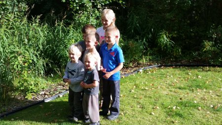
Figure 25 Sierra in back, Levi (green shirt) in front of her, Marcus (blue shirt), David in front of them, Clint in front on left, Isaac in front at right
Here’s a photo Jason being the prince that he is, using his snow blower on our driveway. Trust me, if I had a photo of Cammy, you would see it. She is an attractive woman. I suspect Sierra is going to grow into a fetching woman, and her parents are going to have their hands full managing the hordes of suitors that will come calling.

Figure 26 Can you believe Jason is from Louisiana originally? He sure adapted to life in Alaska.
Jason and Cammy had their belongings loaded onto a truck bound for San Antonio several weeks before we had our things loaded. They had lots of friends from their church in the area, as well as a really nice trailer that they would take camping. For those last couple weeks, they were living in the trailer, with friends, and once in a while, even back at their house, because I would see them, and occasionally get the chance to chat with them. As their departure date neared, I discovered that they were going to drive down the Alaska Hwy in their Suburban, and visit Yellowstone and some family in the Salt Lake City area, before continuing on to San Antonio. I told them I was going to be a day behind them, and that, since they were going to be taking it easy, while I was going to be trying to expedite my passage, there was a good chance we would see each other on the road at some point. I knew that they were going to be retracing the route Jane and I had taken on our way to Alaska in 2012, so I understood that if I did not catch them before Dawson Creek, I would not see them again, because I was going to be heading east from Dawson Creek to Edmonton, and then down through Calgary to Montana. The Miller’s were going to take the scenic route, down through Jasper and Banff. As I started toward Watson Lake, where we had spent a night in 2012, I reminded myself that I needed to keep a watchful eye out for Jason, Cammy, and the kids.
This was a good weather morning, and the scenery was showcased in chamber of commerce splendor as I drove southeast with Teslin Lake on my right for an hour or two. The morning sun on the green hillsides prompted memories of landing at Shannon Airport in Ireland after flying all night from McGuire Air Force Base back in 1970. It wasn’t even close to being identical, but the position of the sun and the stunning shades of green highlighted by it were eerily similar. As is so typical of the Alaska Highway, the traffic thinned out markedly as soon as I got 10 or 15 minutes outside Whitehorse. The reality that I was leaving Alaska and the Yukon Territory behind was starting to sink in. I was really closing one chapter of my life, and opening a new one, and rather than the high speed of an airplane flight or the painfully slow pace of a long illness, I was accomplishing it at highway speed. There was plenty of time to contemplate all that had led to this point in time, and what I hoped lay ahead. After zipping through the little village of Teslin, the road takes you east, while Teslin Lake slowly disappears, continuing in a southeasterly direction. Now, you are traveling just north of the British Columbia border, even dipping into B.C. for 5 or 10 miles at one point.
The next several hours were unremarkable. You can’t really refer to it as “boring”. After all, it IS the Yukon Territory, and there could be a bear or a moose around any corner. You can go many miles without seeing a single house or building. In 2012, Jane and I stayed at a small lodging/café operation a few miles west of Watson Lake. This day, I was hoping to be through that area in the early afternoon, with the only stop being a refueling break at Contact Creek Lodge (Historic Mile 570 of the Alaska Hwy). I motored through Watson Lake pretty much on schedule, loose as it was, took notice of the forest of license plates from all over the world fastened to vertical poles that is the small town’s claim to fame, and just kept going. It had not changed much in 5 years, since the last time I sped through it.
For anyone who has not driven the Alaska Hwy, and most of you probably haven’t, you need to know that if you ever do it, you will want to stock up on maps and a select book or two. Like the vast majority of the folks who drive the road for vacation or relocation (as opposed to the truckers that go up and down it all year long), I had the latest copy of the MILEPOST, which provides detailed info on the entire length of the Alaska Hwy in addition to a number of other roads it connects with. The info is arranged by milepost number, in order. I learned through this experience that if you do not have a co-pilot or navigator, you better know the high points of the day’s route, or pull over somewhere to review the book. I also have a book I purchased in 2012 that is full of valuable information, Guide to the Alaska Highway, by Ron Dalby. Ron travels the highway every year, and has been doing so for decades. One of the key things I learned in his book was that the gas price at Contact Creek Lodge is consistently the cheapest gas along the Alaska Highway. In 2012, after departing Ft. Nelson, and heading toward Watson Lake, I risked running out of gas to try and make it all the way to Contact Creek to fill Jane’s F-150’s cavernous gas tank with the cheapest fuel around. I still have vivid memories of that run from Muncho Lake to Contact Creek, late in the day, seeing bears all over the place, with the sun low in the sky. It all worked out. We loaded up on cheap gas, and continued on to Watson Lake and our lodging for the night, just beyond it. On this 2017 trip, I had not done an adequate job of assessing the mileage between Watson Lake and Contact Creek. I checked the gas gauge as I was leaving Watson Lake, and it gave me confidence that I could make it. I was thinking I only had another 15 or 20 miles to go, so I was feeling fine about my fuel situation. Unfortunately, I had underestimated the distance to Contact Creek. The problem is that when you are southbound, you encounter the original Contact Creek at around Mile 590. There is nothing left but some old ruins. It is another 20 miles to today’s Contact Creek. When I saw the ruins, I started worrying that perhaps this was where I had gassed up in 2012, and it went out of business soon thereafter. I kept going, but the further I went, the more anxious I got. It was imperative that I made it to Ft. Nelson THAT DAY. I had a room booked with a deposit paid. I had the same circumstance the following day in Edmonton. Running out of gas this far outside Watson Lake could be a bit of a disaster. I kept looking at the gas gauge, watching it slowly drop below the E mark. I knew the odds of making it all the way to Muncho Lake, which I calculated to be the next reliable place where I might find gas in very early June were slim to none. At the same time, I hated to give up the 30 or more miles I had already traveled since leaving Watson Lake, just to buy expensive gas and waste over an hour, most likely. Just as I was nearing the point where I felt I was going to have to commit to either backtracking to Watson Lake or making the scary run to Muncho Lake, I came across today’s Contact Creek Lodge. It is a tiny place, with just a couple gas pumps. I was never so happy to see a dumpy wore down gas stop in my life! I just checked the receipt for the gas I purchased, and it was just under 14 gallons; and I have an 18 gallon tank. I think my gas gauge was trying to scare the hell out of me.
The next hour or more of driving was a sheer pleasure. I had plenty of gas, was still pretty much on track to reach Ft. Nelson at a reasonable hour, and the sun was shining. I motored through Coal River and Liard River, famous for its camping and hot springs. The road started gradually climbing, and it dawned on me that I was approaching Muncho Lake. Just about the time I reached the near end of the lake, the clouds started gathering. It was somewhere near the far end of the lake that a thunderstorm hit with full fury. For 5 or 10 minutes, I was driving through a torrent of falling rain, having to watch closely for rocks rolling down the hillside onto the road. Just past the lake, I drove into a construction zone. This was the nightmare that I had feared for months, knowing this trip was coming, and not knowing the status of the extensive construction we had encountered just west of Toad River, between there and Summit, in 2012. I had exhausted every possible means of getting status on the construction, including extensive web searching as June approached. I was flying blind. What I found out was the construction that was under way in 2012 has been completed, but now it has simply moved further west. It is apparent that there is a plan to improve this road all the way to Muncho Lake, so I would expect the construction to persist for at least 3 or 4 more years, possibly much longer.
There were several miles of muddy mess. The only upside was that with all the rain, you didn’t have to worry about a dust cloud. Thankfully, just about the time I reached the section that was being rebuilt in 2012, I drove out of the storm. The weather turned decidedly pleasant. The temperature rose. I had that long downhill from Summit toward Toad River, and I reveled in that high speed pleasure. Before long, I was cruising the last 40 or 50 miles of the day’s drive, and as you approach Ft. Nelson, you start encountering farms and ranches. I started seeing black bears feeding along the side of the road. I counted 8 or 9 in a 4 or 5 mile stretch of highway, and much of it was through farms and ranches. Then I started looking farther out, to see if the bears were all over the place. No, they just seemed to be hanging around up by the road for some unknown reason. All the bears I saw seemed to be feeding on real tall grass.
The sun was low in the sky as I approached Ft. Nelson. I made a beeline for my hotel, the Lakeview Inn & Suites. It was one of several good-sized hotels in the town. We had stayed right next door at a different place in 2012. I parked out front, and entered the lobby to check in. I had just completed that process, and was about to head to the car to start shuttling my belongings to my room, when I noticed Jason, Sierra, and the 2 oldest boys coming in the front door. It was like “old home week”, even though it had only been 4 days since we had said goodbye in Eagle River. We compared notes about our respective drives, and Jason told me he had taken the kids to dinner after a swim in the pool. They continued on, and I went and grabbed some suitcases. This is a 4 story hotel, and I was on the second floor. I got off the elevator, and went down the hall to my room. I had put my magnetic stripe key in the door lock, when the door immediately adjacent to my door (like a foot or two away) opened, and Sierra came out. When she saw me, she got this broad grin on her face, turned around, and got Cammy. Cammy must have been swimming too, because she came to the door with a towel wrapped around her head. It was so amazing. Neither one of us could believe that after driving for well over 1,000 miles, we were staying in the same town, in the same hotel, on the same floor, and right next to each other, after 4 years of living next door to each other!! Cammy started talking about how she hoped the kid’s noise wouldn’t keep me up all night, and I assured her I would be fine. I made several more runs to and from my car, and then headed out to gas up and get dinner.
There are not that many places to choose from for dinner in Fort Nelson, B.C. I was in the mood for something kind of special. Being in Ft. Nelson, a half day’s drive from Dawson Creek, which is the official south end of the Alaska Highway, feeling recovered from my cold, having not run out of gas up near Watson Lake, and then, running into the Miller’s, I was on some sort of “high”. I found a place that looked enticing, by the name of Dan’s Neighborhood Pub. It actually looked slightly upscale, particularly for rural western Canada. Inside, I found a rather nice looking place to hang out. Of course, it was Saturday night, so the place had a good-sized crowd. It was a mixture of groups of young singles, some couples, plus some tables closer to me occupied by older couples anywhere from their late 30s to late 40s. I’m pretty sure I was the only member of my generation in the place, unless they had a 60-something cook or dishwasher in the back. There were a fair number of TV’s around. It was kind of a hybrid bar/eatery/lounge/dance hall/sports bar. I remember having several TVs nearby, off to my left, as I sat at the end of the bar. I watched whatever sport was on, probably playoff NBA basketball, but could have been soccer, but there was nothing particularly exciting. The longer I sat there, the more young singles arrived. The older crowd appeared to be there primarily for dinner. Eventually, a band started playing, and that was likely the draw for the younger crowd, in addition to the evident opportunity to meet members of the opposite sex. The band was nothing to jump up and down about, but they were not bad. They played a lot of music that I am fond of, pop and rock hits from as far back as the 60s and 70 all the way up to “recent”. I remember that at a certain point, a fellow, possibly Dan, the owner, or maybe, the manager, rang a bell or triggered some other noise, and the waitresses started distributing these Jell-O shots I had been seeing them making behind the bar. They had trays and trays of them. My server gave me one. I had to ask her what the occasion was. Essentially, it was just some custom in the place, kind of a thank you to the patrons. I remember ordering hot wings and a Caesar salad, and both were quite tasty. A few of the waitresses were definite “eye candy”, but younger than my kids, so I did not harbor any irrational amorous intentions, just appreciation for how a couple of them would start dancing to the music while working behind the bar, or waiting for a drink order on the other side of the bar. Actually, now that I think about it, one of those women was probably pushing 50. Yes, I thought about hanging around wanting to see if I could get her out on the dance floor, but she was supposed to be working, and I had a long drive ahead of me the next day.
DAY 4, Sunday, June 4, 2017
I’ll never know if Cammy threatened the boys with their lives, or if their father just used the tricks of his anesthesiology trade to put those kids out. I never heard a sound from the room next door until the next morning, when the inevitable sound of a family of 6 getting ready to hit the road surfaced. I was downstairs eating the complimentary breakfast in the space reserved for such activity, just off the spacious lobby, when the Miller family came through the lobby, heading for their Suburban. We said a quick goodbye. Jason said he had a feeling we would see each other again someday. I’m really glad he said that, because it made me feel a lot better about seeing them leave. (When the Air Force approached him about moving to San Antonio, he managed to negotiate a deal where he only has to spend a year down there, and he is guaranteed a spot back in Alaska. We had a lengthy conversation about that up in Eagle River one sunny Alaskan late May evening. I asked him about whether they were going to keep their house or sell it. He said they would probably sell it, because they needed something bigger. I told him I hoped they would find something suitable in the immediate area, because it was such a great neighborhood, with wonderful residents. How many places can you live where you are on the doorstep of Chugach State Park, with its towering peaks, have bald eagles flying around, bears and moose occasionally cruising your neighborhood, multiple networks of groomed, lit nordic ski trails, a high school just on the other side of a forested strip, and a multi-lane freeway just a mile away that can take you to a great little town full of services and restaurants in one direction and a city of 300,000 10 or 15 minutes away in the other direction?)
If you are curious about the preceding paragraph, check out some of my other blog posts from 2017 for photos of the surroundings. I thought about posting a few here, but that would be redundant to those posts, and this thing is already way long.
This trip report is about to speed up, with each successive day taking less space to report on. That is because once you head south of Ft. Nelson, the closer you get to Dawson Creek, the more civilization you start encountering. I think it’s around 300 or 350 miles, but you start seeing the outlying farms, ranches, and businesses as far out as 50-75 miles north of Dawson Creek. I was hitting it as I headed south, wanting to make good time. From a mileage standpoint, there is a good chance this might have been the longest day of the trip. If not, it was a close second. I gassed up in Dawson Creek, and got lunch at an Arby’s if I remember correctly. I know that Dawson Creek and the area around it appears to have grown substantially since I saw it five years earlier. I’m not sure what to attribute that to.
I had wondered in advance of this trip what Grande Prairie, the oil town just over the border into Alberta, would look like. In 2012, we were absolutely dumbfounded after spending almost 3 days around Banff, Jasper, and the area north of Jasper, to find this incredibly fast-growing metropolis out in what we considered “the middle of nowhere”. It has to have its fortunes tied to the oil and gas industry. I remember driving for 50 or 60 blocks, the bulk of it ranging from under construction to brand new to maybe 2 or 3 years old, just to get from the southwest end of the city up the west side to where the main east-west artery came across. There were brand new shopping malls scattered here and there. Many of the big name big box stores were well-represented. I must have seen a dozen Tim Horton’s. It was incredible. When we drove west, out of town, toward Dawson Creek, we kept seeing all these oil industry-related outfits, and untold numbers of trucks that were part of oilfield service companies. It was definitely a boomtown of almost unimaginable size. Of course, the same precipitous drop in the global price of oil and gas in 2013/2014 that clobbered Alaska’s economy, and by extension, me, had to have hit Grande Prairie hard. On this day, I could see ample evidence that the rampant growth had pretty much come to a grinding halt, but the city was still buzzing with activity. It was a Sunday, so you did not have commuter traffic of any significance, but the roads were full of shoppers and recreationalists. There was also plenty of truck traffic on the main drag that I took across town to access the highway that would take me to Edmonton.
I had my “running gun battle” with booking.com to keep me entertained as I sped toward Edmonton. Now I was in an area that was sufficiently developed to have near constant cell signal, so I was seeing emails or messages in real time. I had already communicated with 3 or 4 different booking.com employees. They suffer from the same problem that plagues most real big businesses these days: the impersonalization of their call centers. Every time I would call, I would talk to a different person, and each of these individuals would try and handle my complaint. Part of the problem was that each person had a different slant on things, and would tell me something totally different than the last person I talked to. Eventually, I had a conversation with someone approximating a manager or work group leader that confirmed my worst fears. Booking.com was not about to take ANY ownership of this problem they had created. I resolved that I would provide them the richly deserved negative publicity they deserved whenever the opportunity presented itself. We consumers have to stick together!
The traffic on the drive from Grande Prairie to Edmonton was reminiscent of what you would see on four or six lane freeways in the Lower 48 out away from the big metro areas. I’m thinking of I-70 across western Kansas or I-15 between SLC and Las Vegas. Just like in the Lower 48, as we got progressively closer to Edmonton, the traffic volume picked up. I reminded myself that this was Sunday evening, and most likely, a lot of folks were recreationalists heading home to Edmonton or its suburbs after a weekend in the country. It was twilight when I reached the southwest edge of Edmonton. This is where I had one of those experiences that confirms my belief that we humans are becoming way too reliant on technology for navigation. I was trying to find an expeditious way across the southwest suburbs to my hotel, which was just off the main highway that heads south to Calgary, in the south suburbs of Edmonton. Whatever flaky app I was using on my smartphone kept trying to route me through construction closures, lakes, swamps, and at one point, I swear it was trying to direct me to drive up a tree on a 90 degree corner. In many respects, this was a fitting reintroduction to large scale civilization. For five years, the largest city near where I lived was Anchorage, with a population of around 300,000. Now, I was in a city of just under a million, and a metro area of over 1.3 million. Thankfully, the Hampton Inn that I stayed in, proved to be a wonderful lodging establishment. That’s why I have a preference for those inns. It was dark by the time I arrived. I checked in, and then went out to get a quick dinner and gas up.
I do have to editorialize that I got a look at Edmonton’s skyline from a distance while wandering outside the southwest suburbs. The setting sun was glinting off a few of the tall buildings. I was very impressed, and bemoaned the fact that I would not have a chance to explore the downtown area. That is on my bucket list, along with an extended visit to Calgary, which I fell in love with on the trip north in 2012.
DAY 5, Monday, June 5, 2017
This day was different from all the preceding days. I had the luxury of taking whatever time I deemed necessary to get to my house in Bozeman. The tenants had moved out, and the place was vacant. I had an air bed and my lightweight summer sleeping bag in my car, and those were destined to be my “bed” for the next two nights.
After I had a nice breakfast at the hotel, I drove to a commercial district nearby, and searched for a CD with Scott Helman’s Hotel de Ville album. I discovered that much had changed since last I purchased a CD. The proliferation of broadband internet and apps that support electronic distribution of music has all but liquidated the demand for CDs. I resolved to make one more attempt to procure the album when I reached Calgary.
I deliberately delayed my departure from Edmonton, so I would not be trapped in Monday morning commuter traffic. I knew it would only get so bad, since I was out in the south suburbs, and would be heading south, out of the metro area, when I headed for Calgary. It was a pleasant drive. The weather was ideal. I was amazed at the rich, fertile farms flanking the highway. As I drew closer to Calgary, I could see the mountains off to the west. They exerted a powerful magnetic pull. If you have been to Banff and Canmore, you know what the mountains look like. They are exceptional, with an appearance unique among the mountain ranges I have viewed, including the Alps.
This was my first trip through Calgary on the main highway. In 2012, we left that road shortly before we reached Calgary. Once again, flying solo, without the benefit of a co-pilot or navigator, I found myself wandering around a portion of the city south of downtown. I was simultaneously looking for a place to eat lunch and search for Scott Helman’s album. I failed at both endeavors. I got to see a lot of the suburbs, along with a major medical center and several areas where development was midstream. In frustration, I jumped back on the freeway, and headed south. I knew I would be in Lethbridge soon, and I could at least eat a quick lunch. I visited a Burger King in mid to late afternoon, and continued south.
It was not long before I reached the border, and was back in Montana. The crossing was very routine, with nothing exotic to report. By then, it must have been around 5:00 p.m. or thereabouts. I stopped in Great Falls and gassed up at my favorite truck stop, just off I-15. Then it was non-stop to my house. I have been trying to recall why I chose to stay on the interstate to Boulder and come down that way, as opposed to taking Hwy 287 down through Townsend. I have driven both routes so many times over the years, because multiple jobs I worked in local government required my attending conferences, meetings, special events, and trainings in Helena, the state capital. The only reason I have been able to come up with might have had something to do with wanting to avoid traffic, but this would have been well after rush hour.
It was dark by the time I reached I-90. I don’t remember eating dinner, but I am sure I stopped at some fast food outlet, probably in Bozeman. I knew the cipher code to trigger the automatic garage door opener, and let myself in. Theoretically, my long trip home to Bozeman was complete, but this report is not quite finished.
After the Adventure
Tuesday, June 6 was spent engaged in a number of activities related to my relocation. I had this one day to accomplish any number of tasks. I knew the moving van was not expected to arrive for another 2 weeks or more, but there were so many other things I needed to deal with, including meeting with my property manager to pick up keys, both to the house and to the mailbox. I can’t even remember all the myriad things I was doing that day. It’s all a blur. I just knew that on Wednesday morning, I was getting back on the road, and driving to Colorado to visit family.
On Wednesday, June 7, I left for Broomfield, just north of Denver, to spend time with my parents, and visit other family and friends. I stopped in Billings for lunch, expecting to eat at Del Taco. Much to my surprise and disappointment, Del Taco has left Montana. The next surprise was a hail storm just south of Chugwater, Wyoming. I had been watching the storm as it gathered to the southwest, but by the time I reached the area where it was crossing I-25, it had grown to where it was producing large hail. I literally did a U-turn across the freeway median and retreated back north toward Chugwater to avoid potential hail damage. For five years in Alaska, I had not worried about hail. I don’t remember ever seeing it up there. I had not been back in the Lower 48 for 24 hours, and I was already being assaulted by hail.
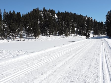
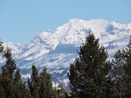
My visit to Colorado went well. I enjoyed my time with family and friends. I managed to get two hikes in at Rocky Mountain National Park, and I will summarize each of those and throw in a photo or two. We also had a barbecue for members of our old co-rec softball team that terrorized our league back in the 1980s.
The first hike was with Jana Fanning. We parked at the Hallowell Park parking lot, then hiked up the Mill Creek Basin trail a ways to where we started bushwhacking up the south side of the ridge south of Moraine Park. We took a slightly different route than I have used in the past, and eventually took the trail that goes over the ridge and descends to Cub Lake. We wandered off-trail and found an area where much of the forest had been logged, probably back in the late 1800s or early 1900s.
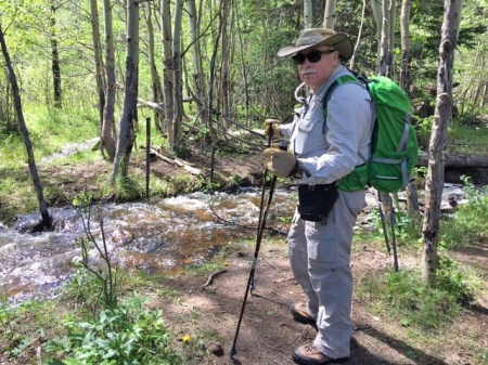
Figure 27 Standing by a runoff swollen Mill Creek

Figure 28 Near top of ridge, with Longs Peak in the background

Figure 29 We found cable/wire off-trail near the top of the ridge
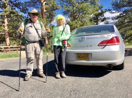
Figure 30 With Jana at trailhead after the hike

Figure 31 North St. Vrain Creek swollen with runoff in Wild Basin

Figure 32 At bridge over St. Vrain Creek – Craig in background, looking at camera – Ken on bridge at right in the shade
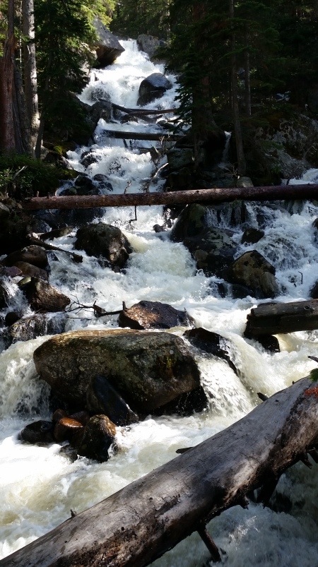
Figure 33 Calypso Cascades in the afternoon sun

Figure 34 Craig photographing Ouzel Falls
I drove back to Bozeman after spending 9 or 10 days in Colorado. I was anxious to be ready for the truck unloading. I had some furniture purchases to make, and a number of other logistical arrangements to make. Unfortunately, the trailer, with our shipment aboard, was still sitting in a lot in Anchorage, waiting for a driver to be available to bring it down the Alaska Highway. Now I know why Jason and Cammy moved out of their house several weeks before driving south; and then they took their time getting to San Antonio. As you can probably imagine, we were given a cascade of excuses, and after the trailer finally made it to the moving company’s terminal in Great Falls, it still took a week and a half to get it to Bozeman. We did not unload until Wednesday, July 5. It was 5 weeks and 1 day since we had loaded the trailer in Eagle River. I have seen shipments from Europe arrive much quicker. The moving company’s excuse: It was their busiest time of year.
Epilog
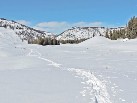
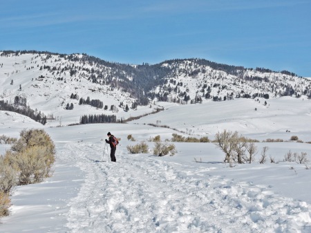
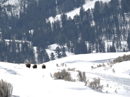
It is now late March, 2018. For anyone from the Brooks Falls Disqus Forum that might be reading this, know that I miss you. My life is substantially different now that I am back in Montana, and working a full-time job. I have minimal time on weekday evenings, and am in bed asleep before the time when I used to get on the Disqus Forum, when I lived 2 time zones further west. On weekends, I am typically in Yellowstone both days between April and October, and at least one of the days in winter. I’m a member of 4 different Facebook Yellowstone groups. I am about to embark on a new adventure, which is creating a Meetup group, titled “Yellowstone 365”, which will run all sorts of activities in or about Yellowstone. There will be day hikes, wildlife watching safaris, skiing, snowshoeing, lunches, dinners, picnics, and attendance at Yellowstone-related educational presentations at venues like Montana State University, the Museum of the Rockies, and other museums outside the national park.
I hope to get back to posting the additional non-fiction bear stories in the series I started while I was in Alaska. With hiking season just around the corner, and the launch of the Meetup group, I’m just not sure when I will get back to it. Maybe in November of 2018.
Thank you for reading this story of my migration from Alaska to Montana. You are invited to use the Comment feature to offer any critique, pose questions you might have, or volunteer any information.